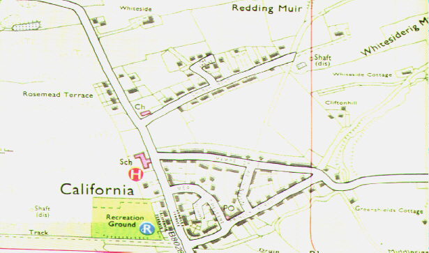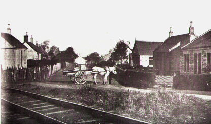
| Located about 4 miles south of Falkirk , or up the Braes as we locals call the area. Although at first glance Princess Street looks very different today, many of the houses in the photograph are still there unaltered. The photograph was taken half way down the street looking east. The railway line was part of a network of light railways that criss-crossed the entire Braes area, built to transport minerals from the local pitheads and quarries. The western half of the present street follows its line but there were cottages some distance to either side of it, with a football field on the photographer's left where Ebenezer Place is now. | |